

Expanding Mine Map Helps Spot Danger at Danish Wind Farm Site
Three wartime mines were found on a Danish offshore wind farm site thanks to help from a UK-based expert company using its pioneering Mine Map.
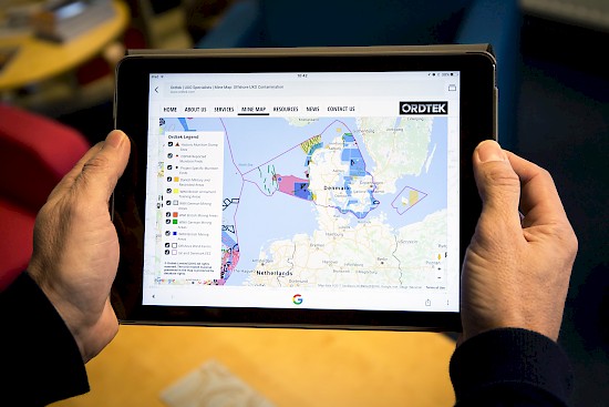
The potentially dangerous relics were found using data gathered by Ordtek, whose charts are used by offshore wind developers to find and remove unexploded ordnance (UXO) – mainly mines and bombs – from the seabed.
Last year the company, from Diss in Norfolk, launched an interactive on-line Mine Map for UK waters, which helped find scores of UXO munitions ahead of wind farm and dredging projects.
Its mapping service, which is mobile device friendly, is now being expanded to Danish waters, where it has already been used on the Horns Rev 3 and Kreigers Flak wind sites.
Ordtek director Lee Gooderham said Mine Map was an important tool to help developers get an early picture of the potential risks, and costs of disposing of them on offshore projects.
“It’s great to be able to expand Mine Map into Denmark and further develop this online resource for all to access.”
The biggest of the Horns Rev mines – a German anti-shipping ground mine from the Second World War – was blown up by the Danish Navy in a controlled explosion at sea. Two other smaller mines from the First World War were removed.
The Horns Rev site, now under construction off Esbjerg on Denmark’s west coast, features 49 187m-tall turbines generating 406.7MW of power – enough to power 425,000 homes.
Ordtek is also helping survey the route of the cable taking power to shore from the Kriegers Flak site off the east coast near Copenhagen.
An estimated 5,000 to 6,000 mines lie in Danish waters, left over from targeting busy shipping lanes during both world wars, including about 70 in the Horns Rev area – but mostly outside the windfarm site.
Ordtek draws its Mine Map data from archives held by a variety of sources including, for Denmark, the German and UK military records. Once risks are identified, ROVs and divers are used to pinpoint the munitions for disposal.
The UK map data helped find UXO at the Rampion and Race Bank windfarm sites, from small rockets to high explosive bombs, as well as old cannonballs in the Solent ahead of dredging for naval shipping.
The successful and growing company has recently moved from Eye in Suffolk to larger premises at Owen Road near Diss railway station, and is aiming to recruit more staff this year.
See the risk on the MineMap.
Trade Press
Regional Press